The group further expands the company’s suite of end-to-end solutions by offering data collection, interpretation, and analysis of natural hazards in real-time to provide a better understanding of risk and preparation for geohazard potential.
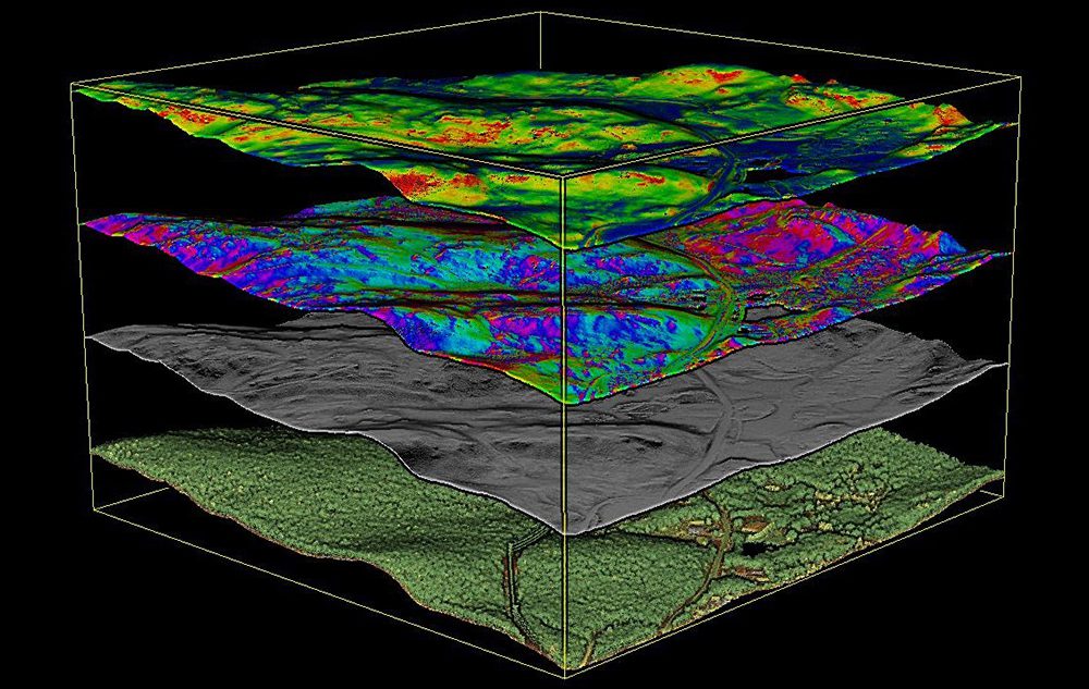
The GAMM team collects and processes many types of geospatial data, including photogrammetry, LIDAR, InSAR, ground based radar, in-ground instrumentation, and orthoimagery to monitor previous and current ground movement and identify concerning trends.
With proprietary analytics, the team leverages the data to evaluate and model the measurement of geohazard frequency, intensity and severity. The ability to collect and interpret critical geospatial data in a robust and scalable way is becoming an industry-game changer in accurately mapping and monitoring at-risk areas. Combining this capability with GeoStabilization’s wealth of experience in slope stabilization helps their clients proactively detect, monitor, manage and mitigate geohazards that affect their assets and the public.
“By utilizing geospatial data, the GAMM group proactively monitors changes, detects early warning signs, and provides risk management through meaningful analysis, said Daniel Lines, VP corporate strategy and development. “With this information, we can better help our customers make proactive, consistent, and fiscally responsible decisions regarding geohazards that threaten their communities and assets.”
The GAMM group furthers GeoStabilization International’s ability to provide the best value to customers through comprehensive monitoring and data analytics for decision support and customized design-build mitigation services. By diversifying its portfolio of services to include real-time data collection and analysis, the company can more precisely predict and plan for geohazards – providing added protection to people and critical infrastructure.
For more information, visit www.geostabilization.com.